[RE]THINKING SMART
Surat, Gujarat, India
“The mark of a great city isn’t how it treats its special places – everybody does that right – but how it treats its ordinary ones.”
PROJECT SCOPE
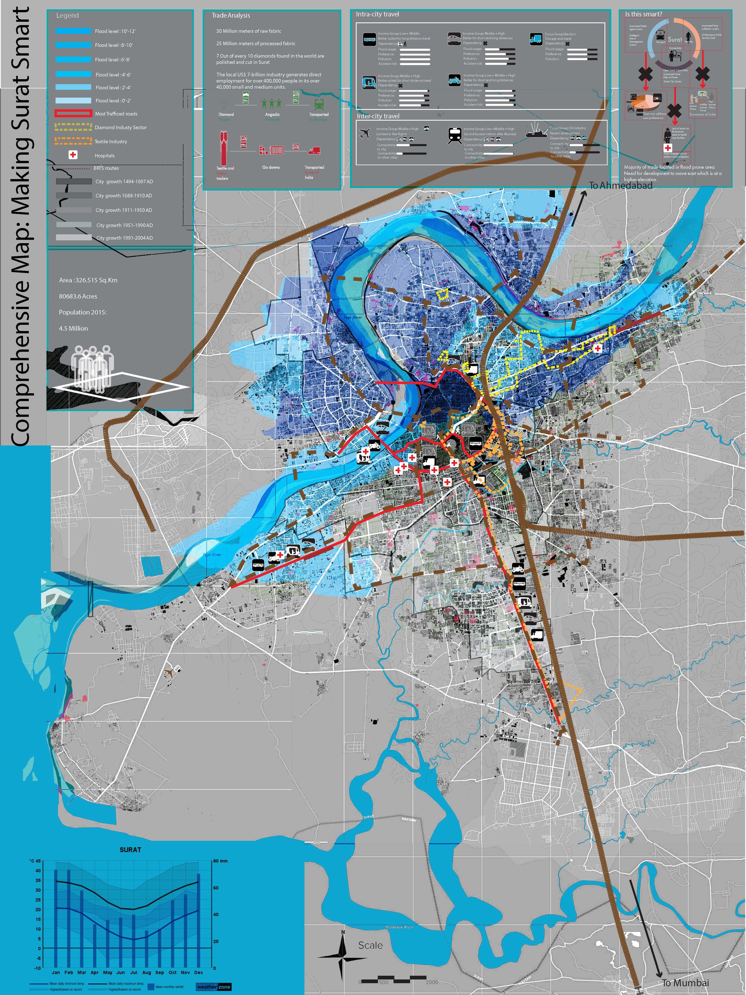
The Smart city mission is one of several major urban development programs focused on India’s rapid growth and is aimed at promoting economic growth, strengthening governance and also improve results for urban residents.In the past three years, many efforts have been made to manage and improve the transportation condition in the city like introducing the Bus Rapid Transit System, working on the Ukai Dam to address flooding etc.
While all these efforts are quite significant in improving the quality of life of the resident, very little citizen participation was taken into account while proposing these ideas. In the transportation sector, Auto rickshaws and motorbikes are the two most common modes of commute in the city. In addition to this, most of the informal sectors that operate rather efficiently within the city are not taken into consideration.
SITE ANALYSIS
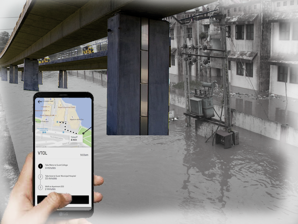
Within Surat, Auto rickshaws and motorbikes are the two most common modes of commute in the city. Although The Bus rapid transit more economical, it is not as convenient as either of the above mentioned modes of transport. In the event of a flood, all the modes are road-based and more prone to damage. In addition to this, most of the informal sectors that operate rather efficiently within the city are not taken into consideration. The angadia’s that transport large amounts of cash and diamonds from Surat to Mumbai and other parts of the world, mainly use the railways and roadways due to inefficient air transit in Surat. If Surat were to become India’s first smart city attracting different logistic centers and businesses, there is a need to address connectivity within the city and to places outside the city. It is also about creating better connectivity between the formal and informal economy/sectors/modes of transportation. In addition to this, it is important to find more ecologically sound ways of controlling the flood that would also benefit the communities along the river (Angadias, 2013).
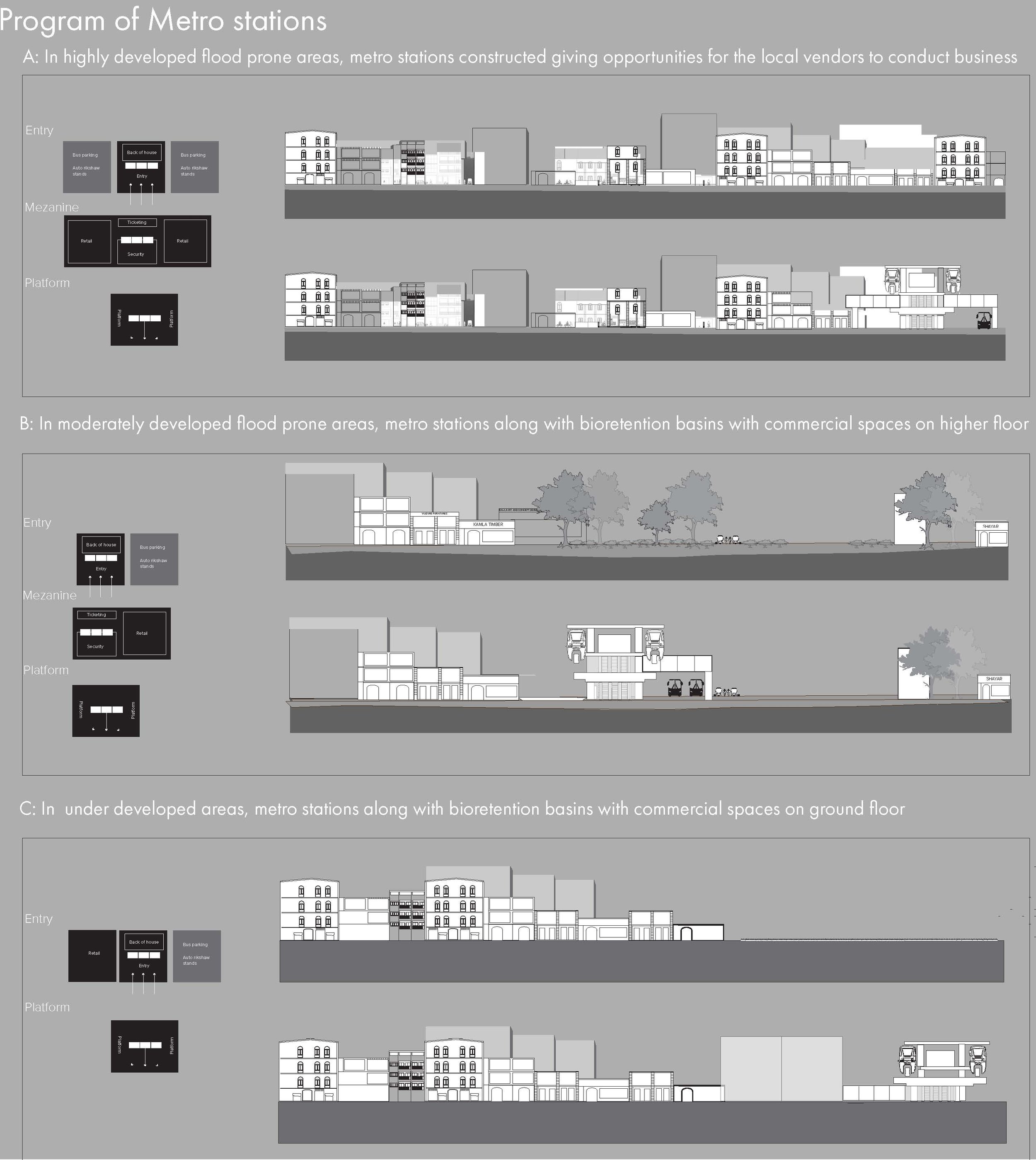
PROGRAM
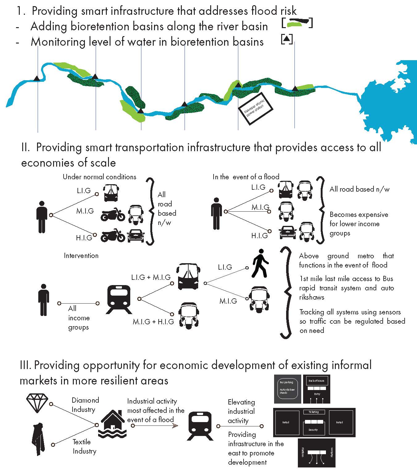
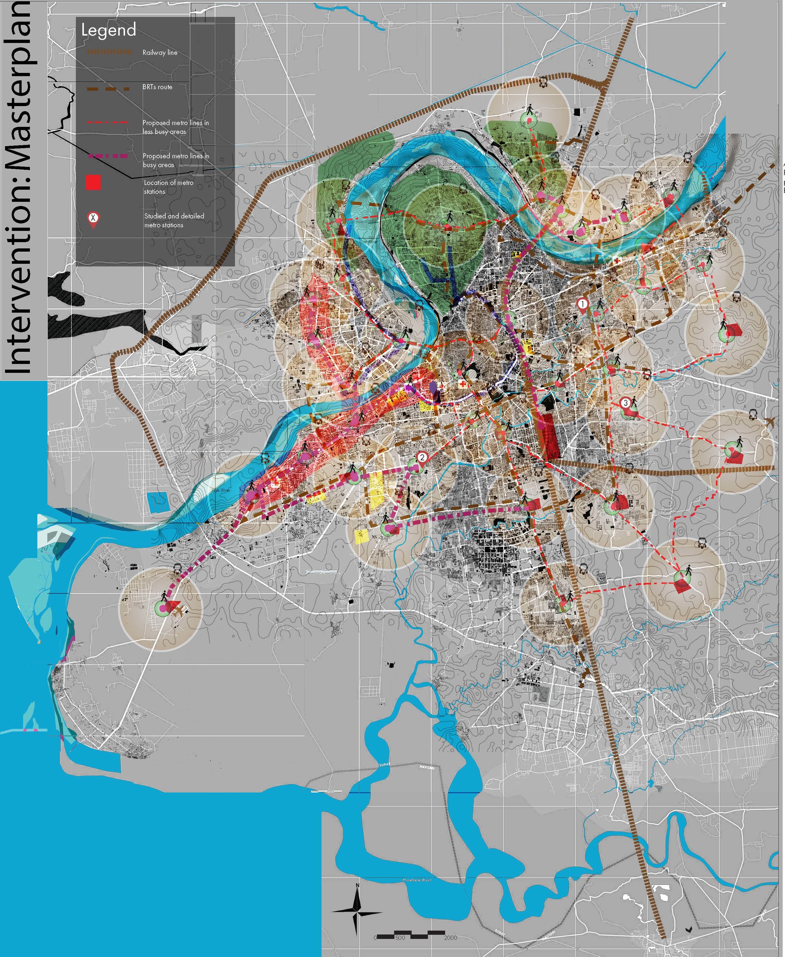
The program of the intervention incorporates the following goals that develop flood mitigation strategies as well as a network of connectivity that:
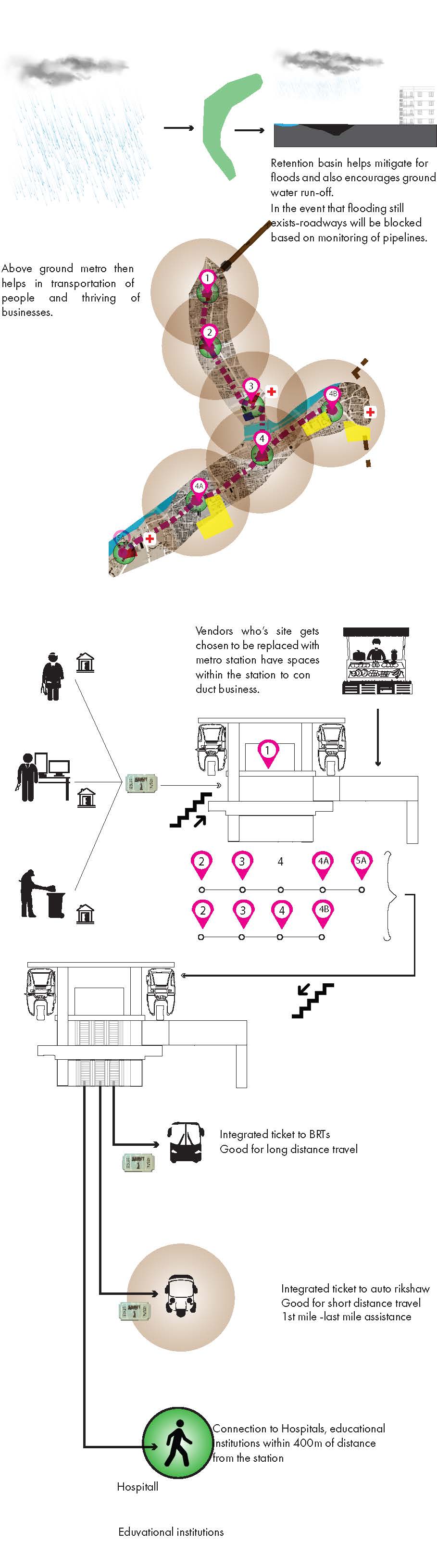
Providing smart infrastructure that addresses flood risk: Adding Bio-retention basins along the Tapi river in the 94 Km stretch before it reaches Surat. Installing Sensors in each of these retention basins that will monitor the level of water in these basins.
Providing smart transportation infrastructure that provides access to all economies of scale. All road based networks as mentioned before are prone to floods. An above ground mass transit system that will address all sectors of the community- an above ground metro is the next planned phase of the intervention.
Using the metro stations as spaces where informal activities can continue to develop and act as revenue sources even during floods