URBAN [RE]STRUCTURING
Xi’an, China
“The ability to simplify means to eliminate the unnecessary so that the necessary may speak.”
PROJECT SCOPE
As part of the final semester design exploration project in Sustainable design, the class was divided into three groups. Each group was asked to choose a real-life problem and apply our learnings in architecture, landscape architecture and urban design to it. The world was our ocean, we could pick any problem we wanted and provide our solutions to it. My team and I began our research. We looked at the canal problem in Venice, the slum problems in India, the flooding problem in New Orleans, and finally the flooding problem in Xi’an. As a collective, we each researched a location and then presented the research to the team to then pick the most interesting problem to solve. Upon much deliberation and discussion, we agreed that Xi’an offered the most diverse set of problems and as a design exploration exercise, would give us the most exposure to apply all that we had learned.
DESIGN EXPLORATION


This problem statement led us to evaluate design solutions on 3 different scales as shown below:

PHASE 1
As part of phase 1, our design solutions focussed on providing access to good quality water by localizing water collection and filtration. We researched the zoning in the city of Xi’an.

The first phase was focussed on residential areas with traditional chinese courtyards which we found were incredibly high in number. We proposed repurposing the courtyards to rain gardens that will also filter the water going into the households.


PHASE 2
The second phase of the design solutions focussed on expanding collection and filtration of water to the inner city and utilizing waste to compensate for dependency on fertilizers and pesticides.
In order to best represent this research, see below a map of the infrastructure in the city of Xi’an

In public transportation facilities that were being constructed, waste can be separated, filtered and re-used.
In public transportation facilities close to agricultural fields, waste can be separated and used for agriculture.

PHASE 3
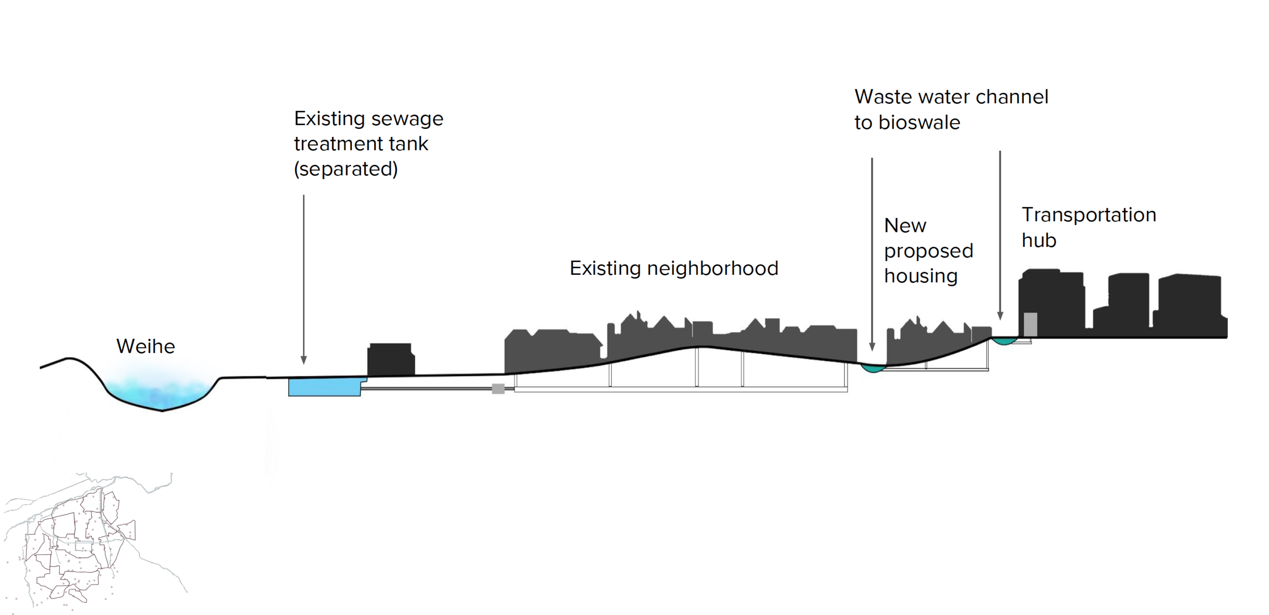
Phase 3 focussed on the design of a wetland systems in and around the city that ties to the infrastructure proposed in Phase 1 and Phase 2. It also addresses the sedimentation problem associated with the river to reduce the risk of flood and drought.


In addition to the above proposed solutions, we also looked at possible ways of stabilizing the river bank using naturally found materials in the area.

To address the inner city channels, the river bank stabilization would take a slightly different approach. We proposed vegetated mounds, gabion walls and naturally found willow trees around the river.


In conclusion, our solutions to be deployed in three phases aim to:
Reduce flood risk
Control Sedimentation
Reduce drought risk
Improve water quality
